You own the land. That doesn't mean you know what it allows.
Most property owners have a general sense of what they want to build. A house. A shop. An ADU for aging parents. A garage with a guest suite above it.
What they usually don't know is what the property actually permits. And the gap between “what I want” and “what the site and the rules allow” can be wide.
Figuring out what you can build starts with a few specific research steps. Some you can do yourself. Some need professional help. Here's the full process.
Start with your zoning designation
Every parcel in Washington has a zoning code. That code determines the types of structures allowed, their size, their height, their placement on the lot, and sometimes their appearance.
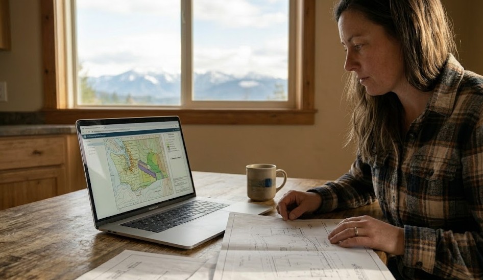
To find your zoning, go to your county's or city's online GIS mapping tool. Search your parcel by address or parcel number. The map should display the zoning designation.
Once you have the zoning code, look up the corresponding section in the municipal or county code. It will list permitted uses (what you can build by right), conditional uses (what you can build with special approval), dimensional standards (setbacks, height, coverage), and any special conditions.
In Seattle, zoning categories include single-family, lowrise, midrise, and commercial zones, each with different allowances. In unincorporated King County, you might see RA (Rural Area) zones with very different rules. Spokane, Tacoma, and Bellingham each have their own zoning frameworks.
Check for overlay zones and special designations
Base zoning tells you the default rules. Overlay zones add restrictions or modifications on top.
Common overlays in Washington include critical area overlays (wetlands, steep slopes, habitat), shoreline designations, historic preservation zones, airport compatibility zones, and urban village or mixed-use overlays.
These overlays can significantly change what you're allowed to build. A lot zoned for residential construction might have a critical area overlay that reduces buildable area by half. A property in a historic district might have design review requirements that affect materials and appearance.
Check for overlays in the same GIS system where you found the base zoning. Our environmental reviews flag critical area designations that affect your buildable footprint.
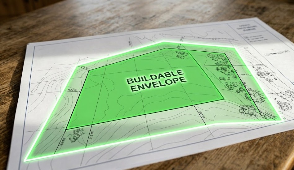
Understand setbacks and the buildable envelope
Setbacks are the minimum distances your structure must be from property lines, roads, and other features. Front setback, rear setback, side setbacks. They're defined in the zoning code and they vary by zone.
Once you apply setbacks to your lot, you get the buildable envelope: the area where a structure can legally sit.
On a large rural parcel, setbacks might barely matter. On a standard suburban lot in Bellevue or Tacoma, setbacks can leave a surprisingly small building footprint. A 7,200-square-foot lot with 20-foot front and rear setbacks and 5-foot side setbacks might have a buildable rectangle that's only 50 by 32 feet.
Knowing your buildable envelope before you design anything prevents expensive surprises.
Don't just look up the setback numbers. Draw them on a site plan or have a professional do it. Seeing the actual buildable rectangle — especially after accounting for easements and buffers — gives you a realistic picture that numbers alone don't convey.
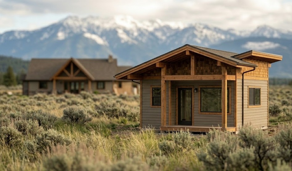
Find out about ADUs and accessory structures
Washington State has been expanding ADU (accessory dwelling unit) allowances in recent years. Many jurisdictions now permit detached ADUs, attached ADUs, or both — but the specific rules vary by location.
If you're thinking about adding a guest house, in-law unit, or rental unit to your property, check your local ADU ordinance. It will specify maximum size, parking requirements, owner-occupancy rules (if any), and setback modifications.
Accessory structures like garages, shops, and barns have their own rules. Maximum size, height, and placement relative to the primary structure and property lines are all regulated.
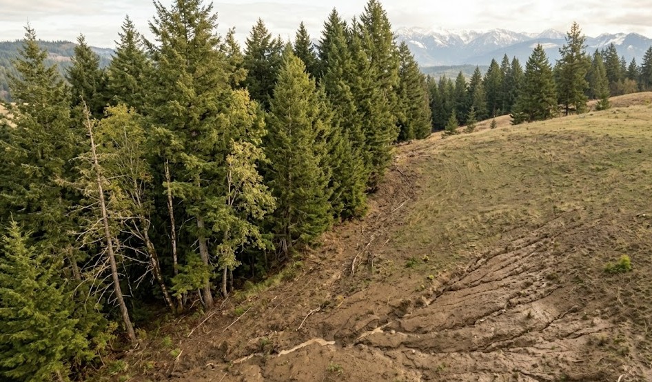
Account for site-specific constraints
Zoning tells you what's allowed on paper. Your specific site adds another layer.
Septic limitations may restrict where structures and impervious surfaces can go. Slope and drainage may limit grading and foundation options. Wetlands and streams create buffers that reduce usable area. Utility locations and easements may cross through portions of your lot.
These site-specific constraints don't show up in a zoning code lookup. They show up in a feasibility study or a site evaluation.
If your property has been untouched for years, conditions may have changed since it was last evaluated. Wetland boundaries shift. Trees grow and create new canopy cover that may affect habitat designations. A current evaluation of site conditions is worth more than old data.
When to call the county and when to call a professional
Your county or city planning department can answer basic zoning questions. They'll tell you the zone, the setbacks, and whether a particular use is listed as permitted or conditional.
What they won't do is evaluate your specific site for construction viability. They won't assess septic options, calculate utility extension costs, or map your actual buildable envelope accounting for all constraints.
For a full picture of what you can build, you need someone who combines code knowledge with site evaluation. That's what MKG Construction's feasibility studies provide. We look at both the regulatory framework and the physical site conditions for your specific parcel — and our permitting and coordination team handles what comes next.
Getting from “what can I build” to actually building
Once you know what's allowed and what the site supports, you're in a position to make real decisions. Design decisions. Budget decisions. Timeline decisions.
MKG Construction helps Washington landowners through the full process: from feasibility evaluation through permitting and coordination to custom home building. Every step is transparent. Milestone-based payments. No hidden fees.
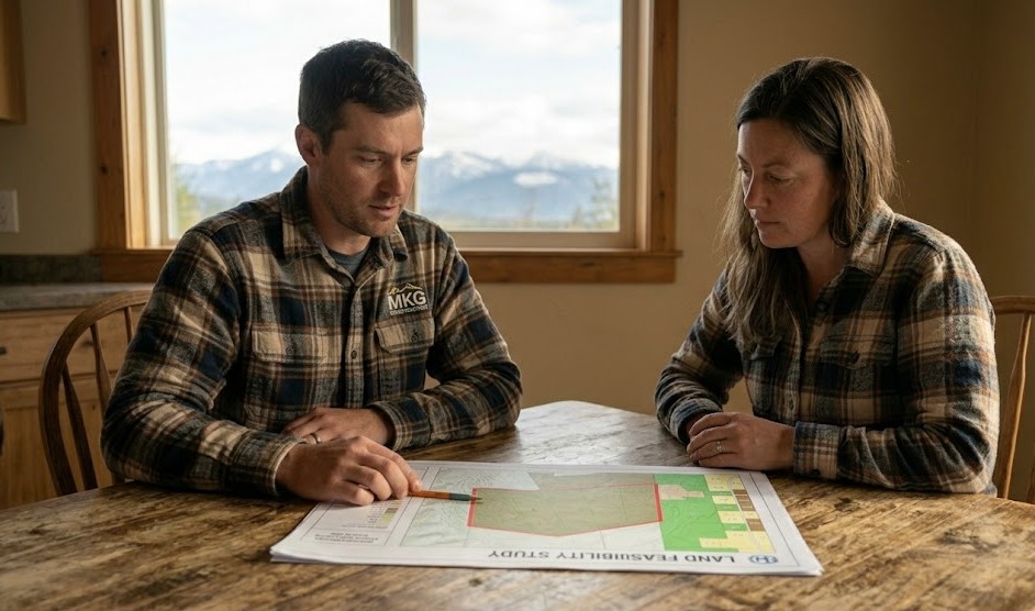
Want to know exactly what you can build on your Washington property? MKG Construction's feasibility studies evaluate your parcel's zoning, setbacks, environmental constraints, and site conditions. Clear answers. No guesswork.
Book a consultation